From Cassis to the Parc National des Calanques
The fourth stage takes us on the GR 51 from Cassis to the spectacular fjord landscape of the Parc National des Calanques. Before starting the hike, however, you should find out whether the nature reserve is open for crossing.
In case of acute danger of forest fire (high temperatures or strong wind) the access for hikers is prohibited! This is especially between early July and mid-September regularly the case. The tourist office of Cassis informs directly on site and online about the access regulations (Link: https://www.ot-cassis.com/de/zugang-zu-den-calanques.html). Alternatively, information can also be found here: http://cg13.eway.fr/conditions.php. There, during the season, a daily updated table for the entire department of Bouches-du-Rhône is provided - for our hike, the third entry from the bottom is relevant ("Les Calanques entre Marseille et Cassis").
If access is closed, be sure to respect this: being in such a difficult-to-access area when there is a risk of forest fire can be life-threatening. Those who are affected by the closure and therefore cannot continue hiking as planned should allow themselves an extra night in Cassis, take a boat trip to the Calanques, lie on the beach or visit one of the wineries in Cassis (more info here: https://www.ot-cassis.com/de/). Those who hike between October and the end of May are on the safe side: the law, on the basis of which access can be regulated, is only applicable between 01 June and 30 September.
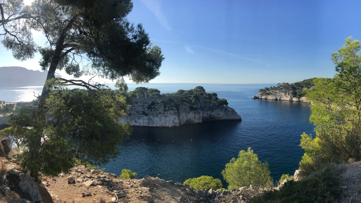
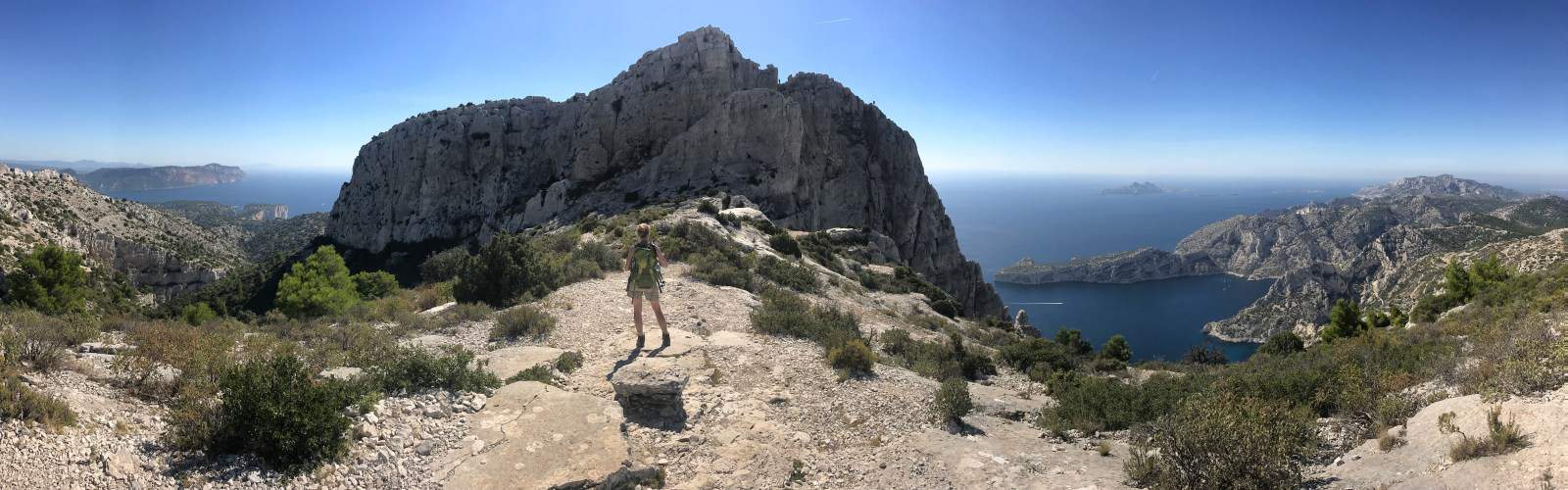
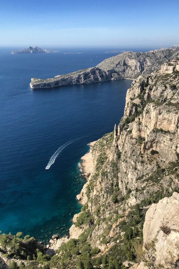
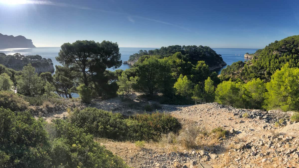
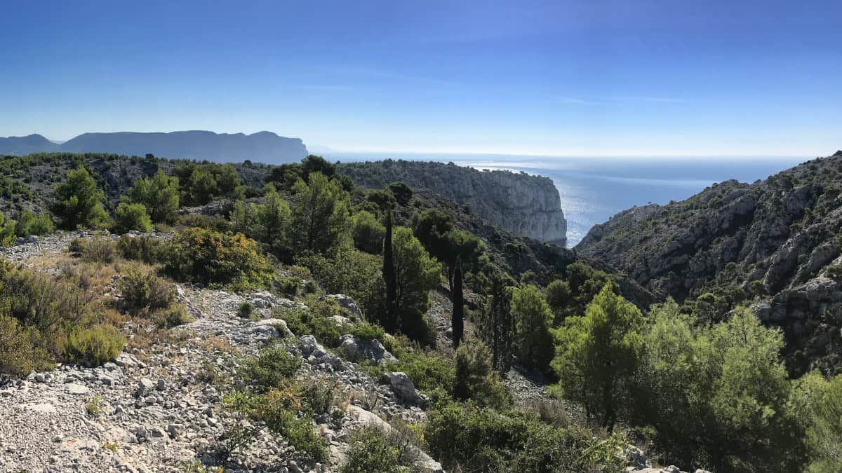
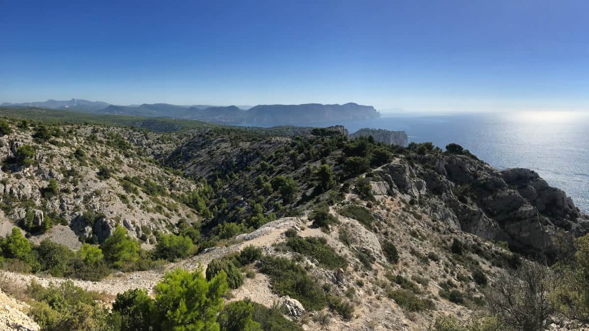
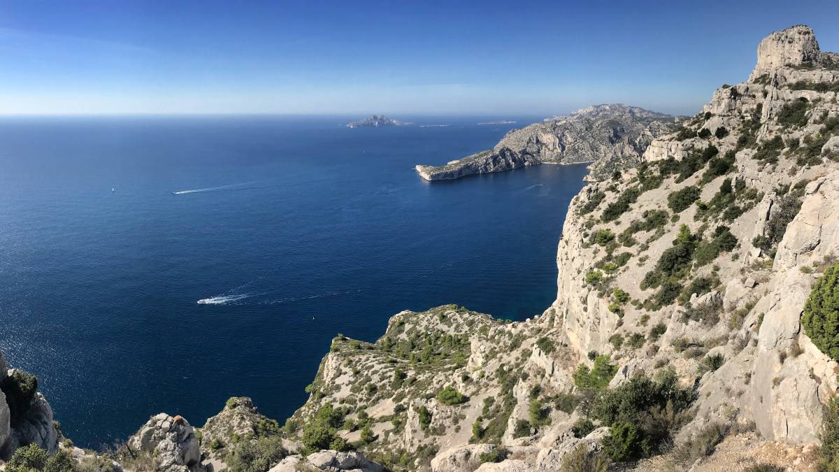
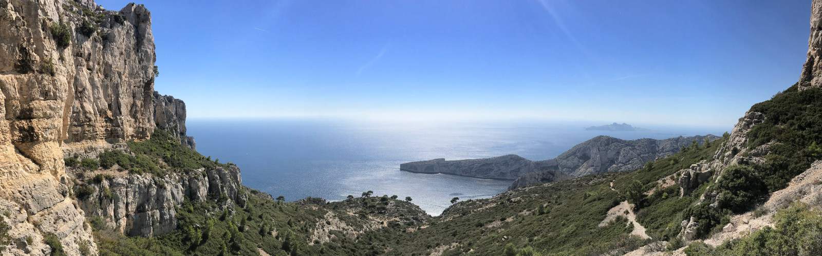
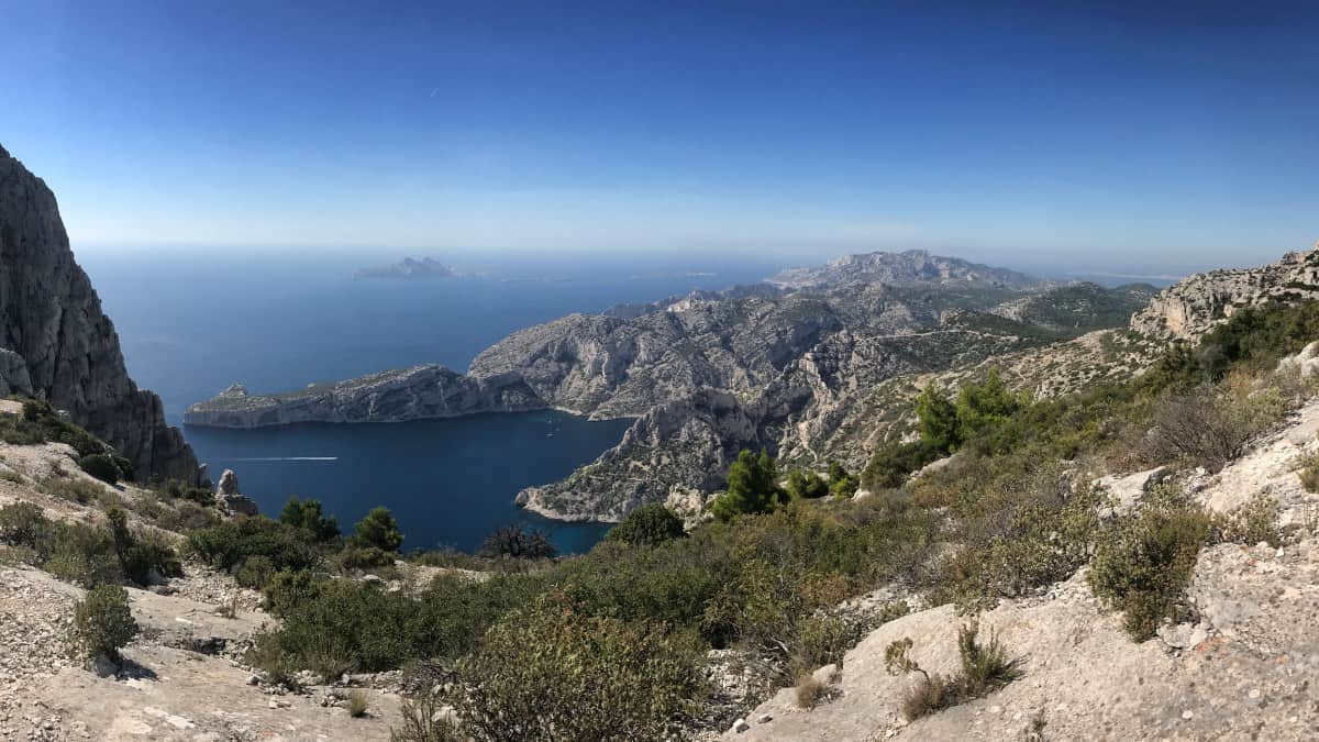
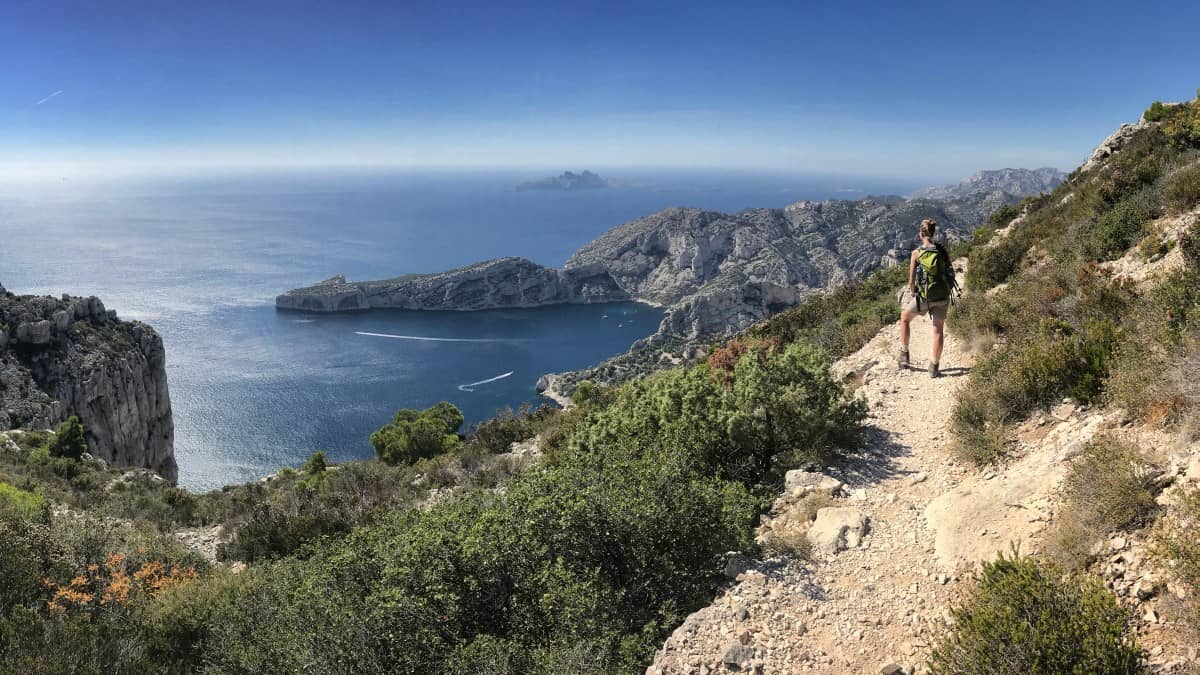
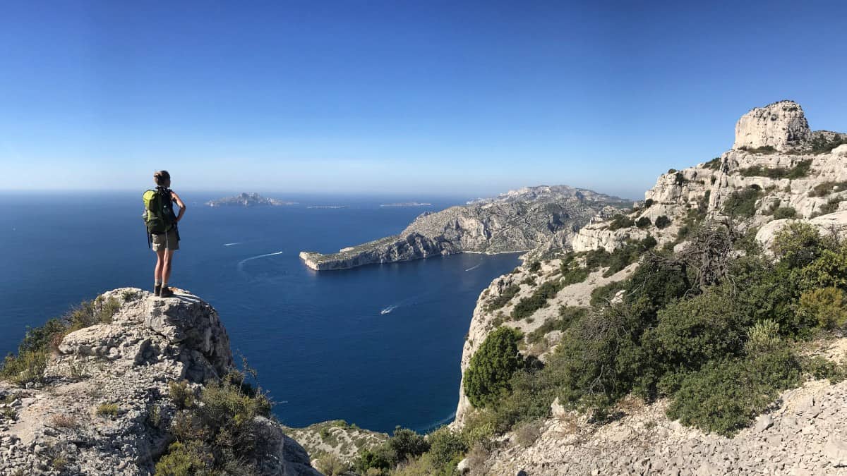
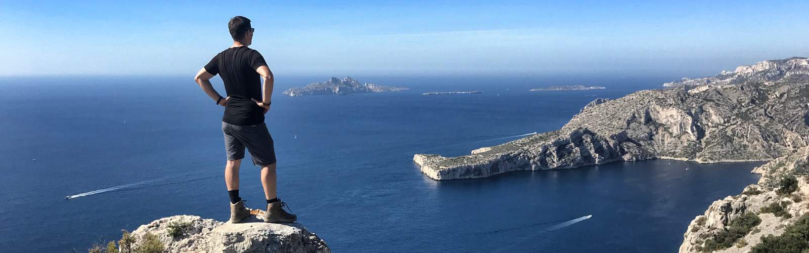
Today's hiking route leads us first along the natural harbor of the Calanque de Port-Miou and then on the GR 51 into the nature reserve. There is some up and down with quite a lot of altitude to overcome. But the effort is rewarded in clear weather with a 180-degree view over the entire coast: In the east, the reddish cliffs of Cap Canaille are visible, right behind it rises the silhouette of Cap Sicié (near Toulon). The eye-catcher in the west is Cap Morgiou with the calanque of the same name.
Facts about stage 4
Route: 15.7km
Altitude: 780 m ascent / 690 m descent
Duration: 6:30h (without breaks)
See also elevation profile
Downloads details
Refreshment stops along the way
No places to stop for refreshments on the way, take enough water and provisions with you!