From La Ciotat to Cassis
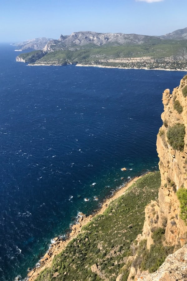
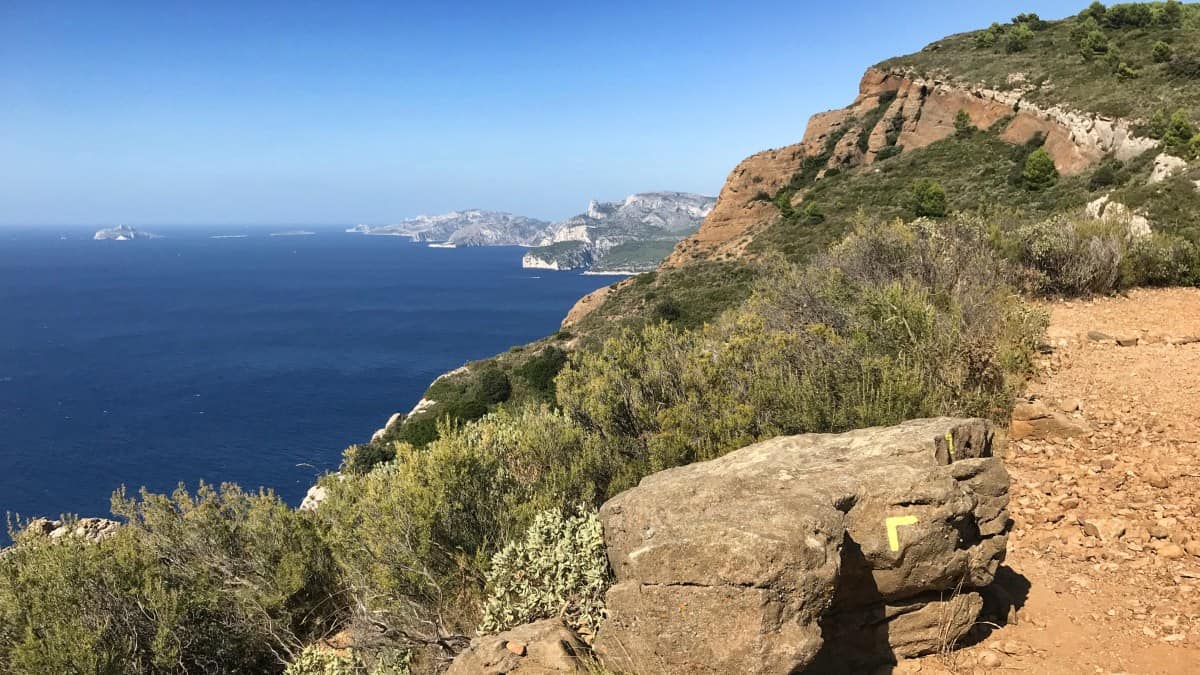
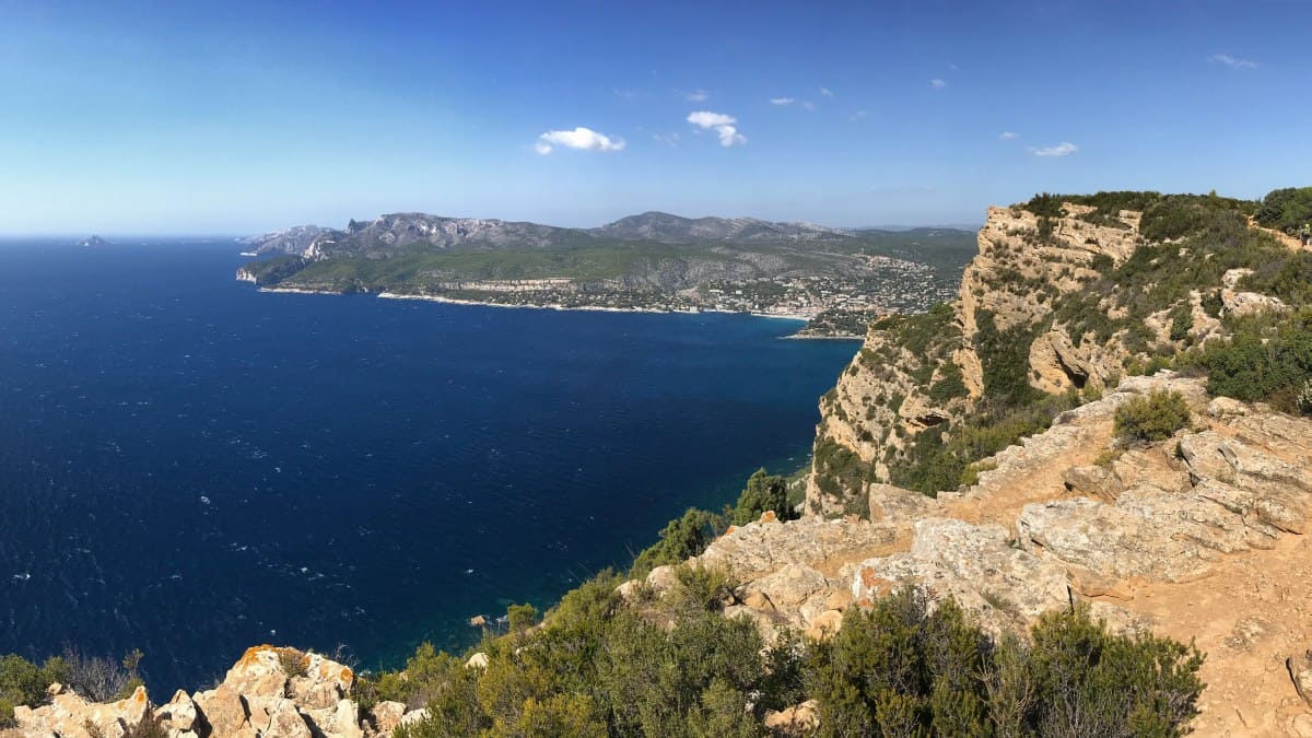
The third stage takes us along the Sentier du Cap Canaille from La Ciotat to Cassis. The route runs over the highest cliffs in France - spectacular views are guaranteed! In La Ciotat we should stock up on provisions and water, as there are no rest stops along the way.
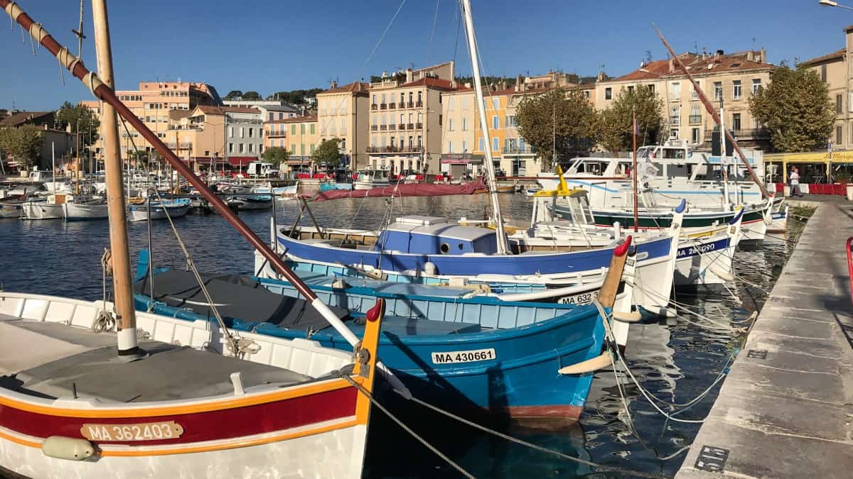
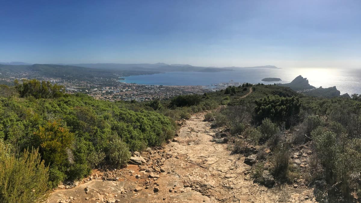
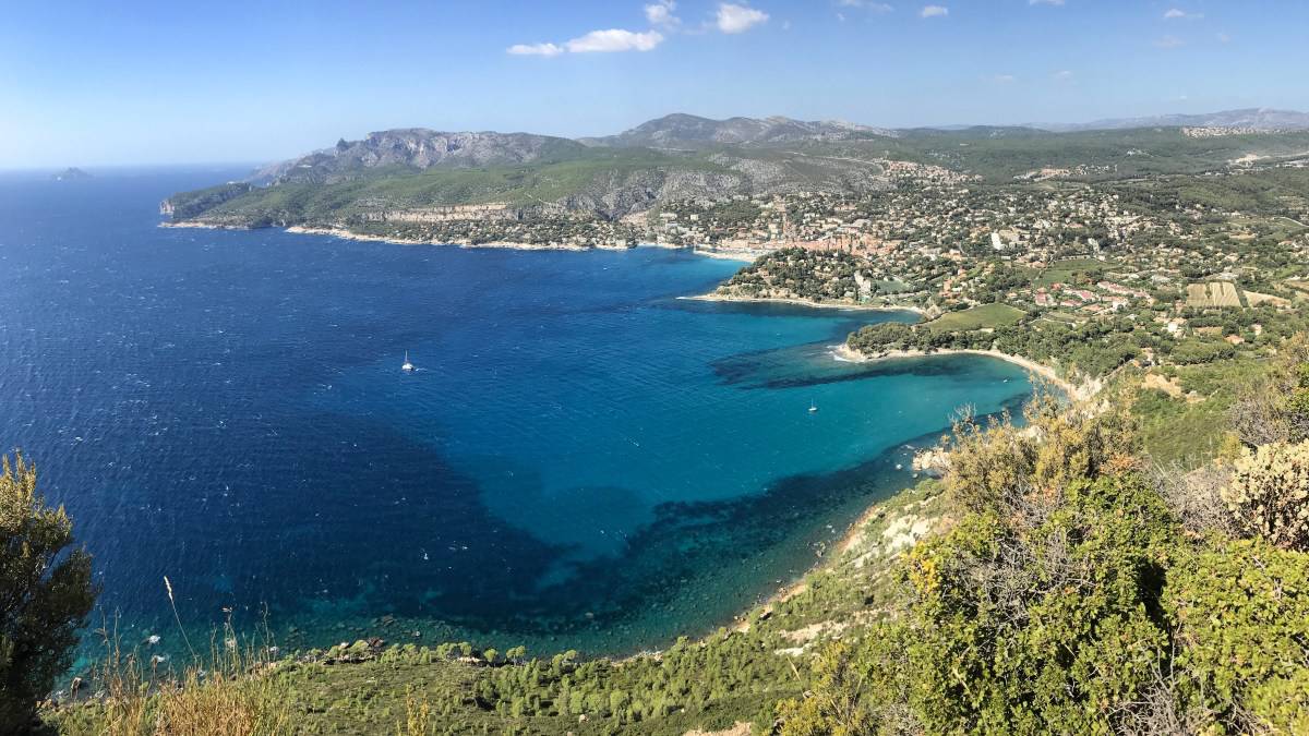
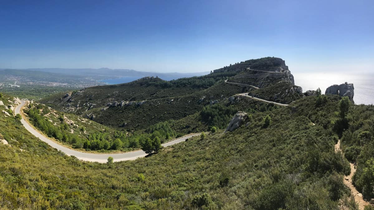
Even the ascent is worthwhile: the harbor of La Ciotat with its neighboring, strikingly towering cliffs is always worth a look back. At the top we cross the access road to the signal station and follow the yellow marked Sentier du Cap Canaille to the west. From now on, the path winds almost exclusively along the edge of the cliffs, sometimes up, sometimes down. Only in a few places do we touch the panoramic route known as Route des Crêtes for motorists.
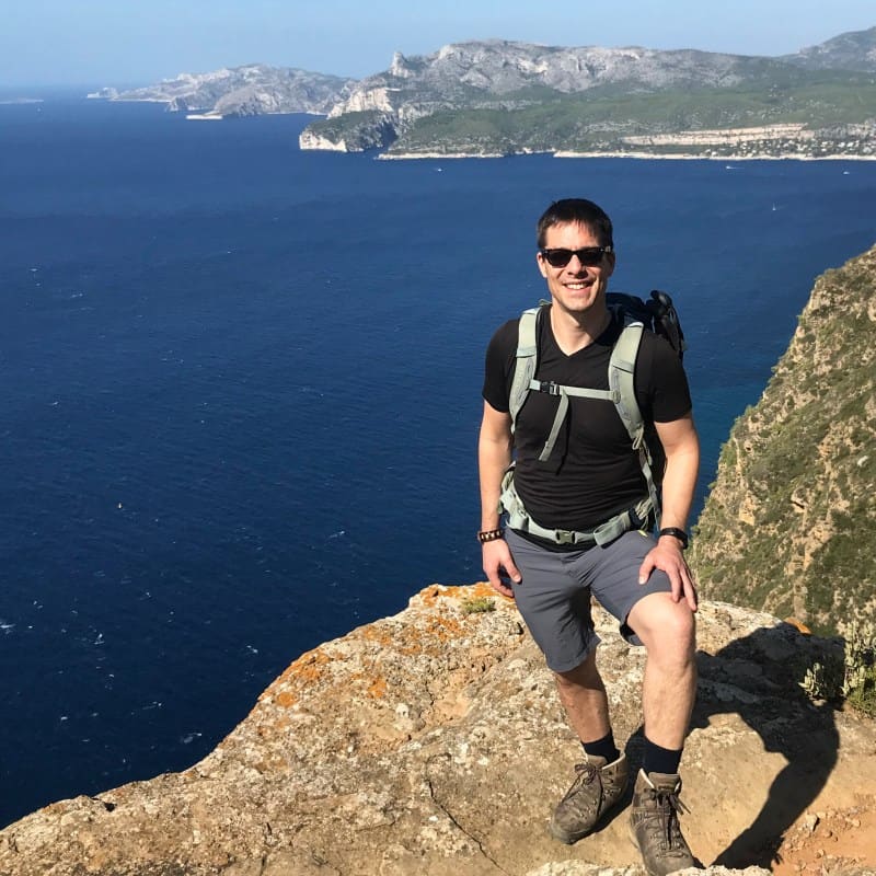
The highlight of this long-distance hike lies ahead of us: the Massif des Calanques with its fjord-like bays. Today we enjoy the view from a distance, tomorrow we will cross the mountain massif at the height of the pointed hump (Grand Candelle).
At the end of the cliff tour we meet again the Route des Crêtes and the GR 51, which we now follow to Cassis.
Facts about stage 3
Route: 10.9 km
Altitude: 630 m ascent / 630 m descent
Duration: 4:45h (without breaks)
See also elevation profile
Downloads details
Refreshment stops along the way
No places to stop for refreshments on the way, take enough provisions and water with you!