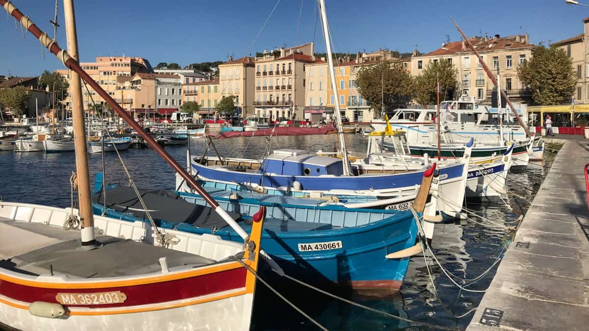
From La Ciotat to Cassis
Stage 3: Directions
From La Ciotat to Cassis
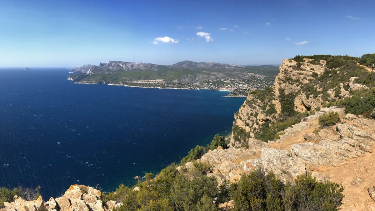
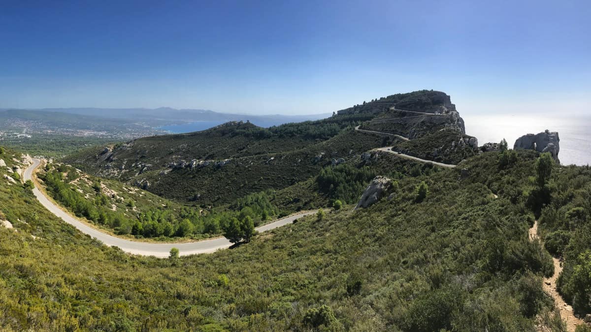
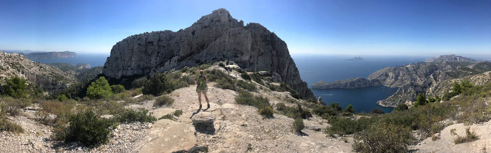
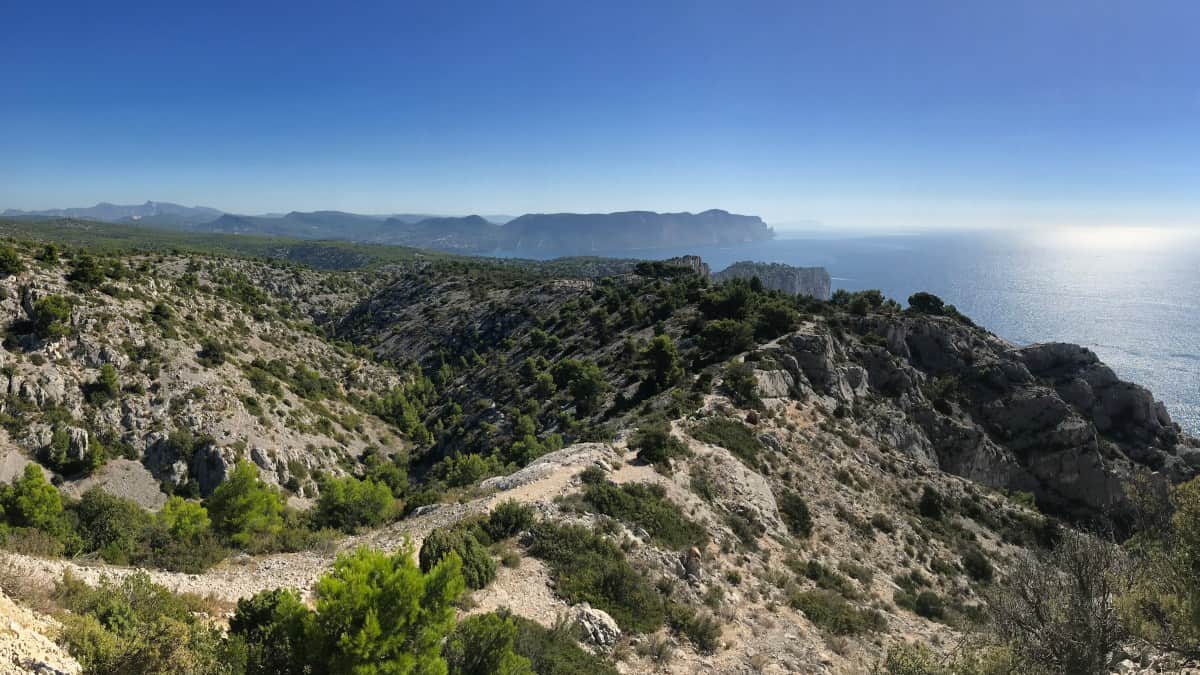
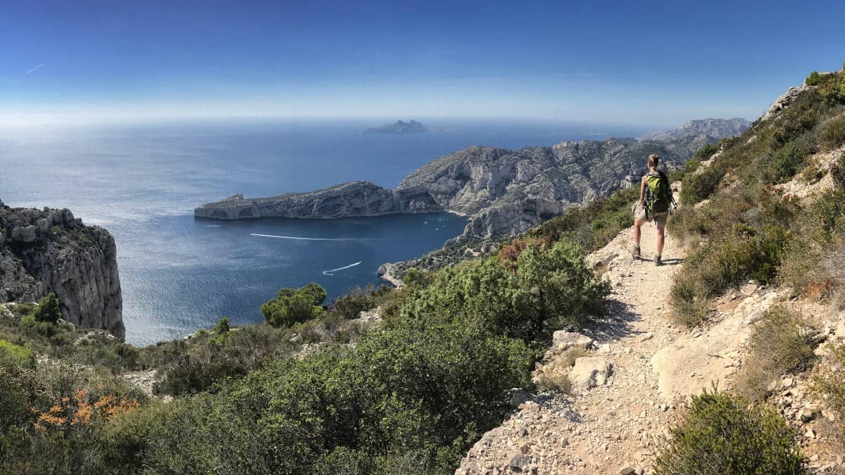
The third stage takes us along the Sentier du Cap Canaille from La Ciotat to Cassis. The route runs over the highest cliffs in France - spectacular views are guaranteed! In La Ciotat we should stock up on provisions and water, as there are no rest stops along the way.
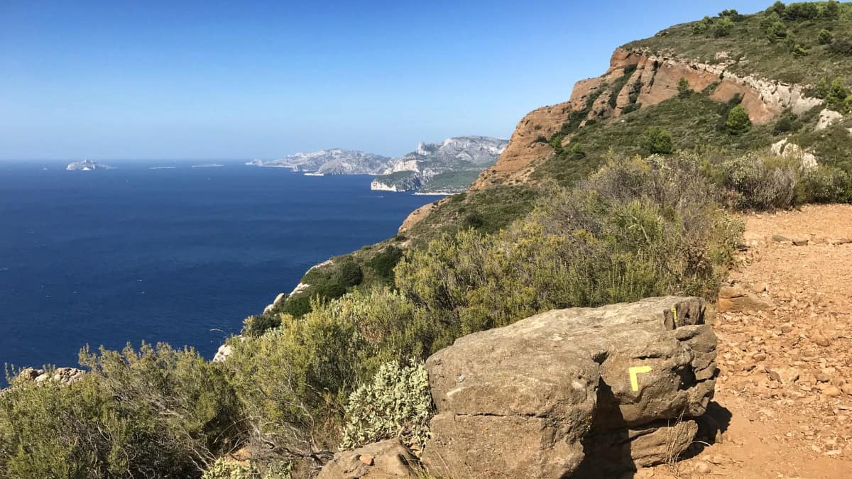
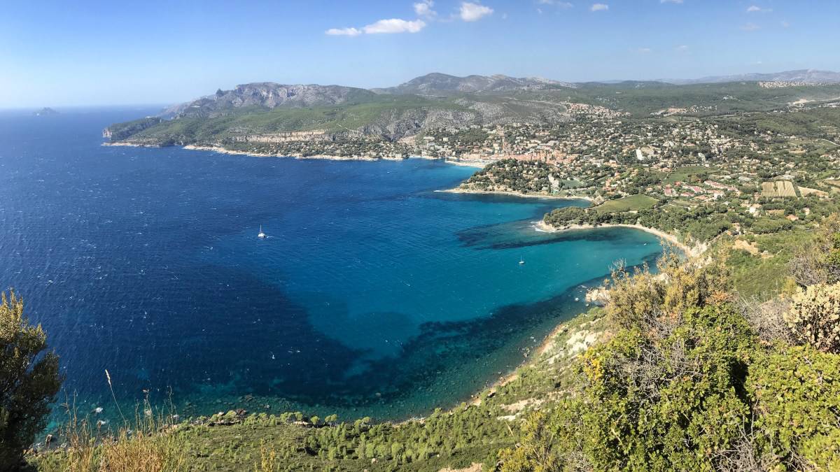
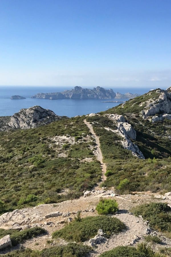
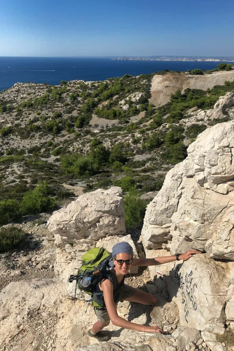
Even the ascent is worthwhile: the harbor of La Ciotat with its neighboring, strikingly towering cliffs is always worth a look back. At the top we cross the access road to the signal station and follow the yellow marked Sentier du Cap Canaille to the west. From now on, the path winds almost exclusively along the edge of the cliffs, sometimes up, sometimes down. Only in a few places do we touch the panoramic route known as Route des Crêtes for motorists.
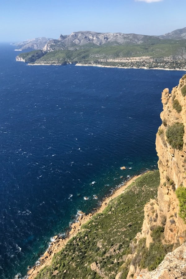
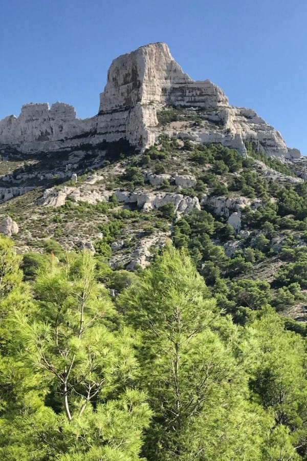
The highlight of this long-distance hike lies ahead of us: the Massif des Calanques with its fjord-like bays. Today we enjoy the view from a distance, tomorrow we will cross the mountain massif at the height of the pointed hump (Grand Candelle).
At the end of the cliff tour we meet again the Route des Crêtes and the GR 51, which we now follow to Cassis.
Facts about stage 3
Route: 10.9 km
Altitude: 630 m ascent / 630 m descent
Duration: 4:45h (without breaks)
See also elevation profile
Downloads details
Refreshment stops along the way
No places to stop for refreshments on the way, take enough provisions and water with you!


Stage 3: accommodation

Green inner courtyard with restaurant in the hotel "Le Clos des Arômes"
Overnight stay in Cassis
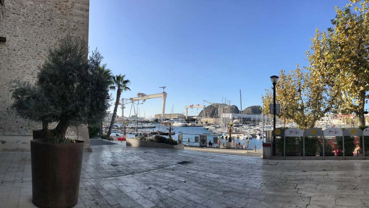
The small port town of Cassis is favored with its location in several respects: From Cassis you can enjoy a magnificent view of the cliffs of the Cap Canaille, in addition, there is a large natural harbor in Cassis in addition to the port in the town center. In addition, the town is an ideal starting point for excursions of all kinds to the Parc National des Calanques. And not to forget: the Côte d'Azur, France's most famous and most expensive coastal region, begins in Cassis! Also the fact that Marseille is only 30 km away, does not exactly provide for favorable prices. Cassis lives from tourism and accordingly large is the offer of accommodation, but these are usually rather high priced.
Despite relatively extensive research in advance and directly on site, we therefore have no really hot hotel recommendation for Cassis. There is always a catch: either the rooms are relatively expensive or somewhat cheaper, but very small, further outside, poorly rated or located on a thoroughfare.
Tip: many hotels and guesthouses in Cassis plan with a minimum stay of 2 nights. Therefore, if you take a rest day in this beautiful place in the middle of the long-distance hike, you usually have a bigger and better choice of accommodation.
We ourselves chose Le Clos des Arômes on our tour and thus one of the rather inexpensive hotels (link: Le Clos des Aromas). The hotel is relatively quiet at the upper end of the old town and has a large, leafy courtyard with a well-attended restaurant. We tried two different rooms there: the standard double rooms are plain and okay (about 100€ + breakfast), but in the economy double room (80€ + breakfast) the bathroom is so cramped that it is burdensome to use the toilet.
As an alternative, we still had the comparatively more expensive Hotel Le Golf in mind (Link: Hotel Le Golf). There at least the rooms with sea view seem to be decent.

The Hotel le Golf is located directly on the harbor of Cassis

The standard double room at "Le Clos des Arômes"

One of the bathrooms in the standard double rooms at "Le Clos des Arômes"
Stage 4: map
From Cassis through the Parc National des Calanques to Les Baumettes
Stage 4: Directions

From Cassis to the Parc National des Calanques
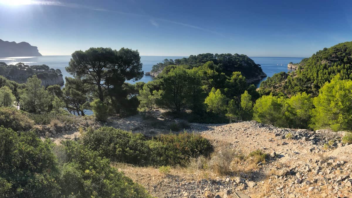
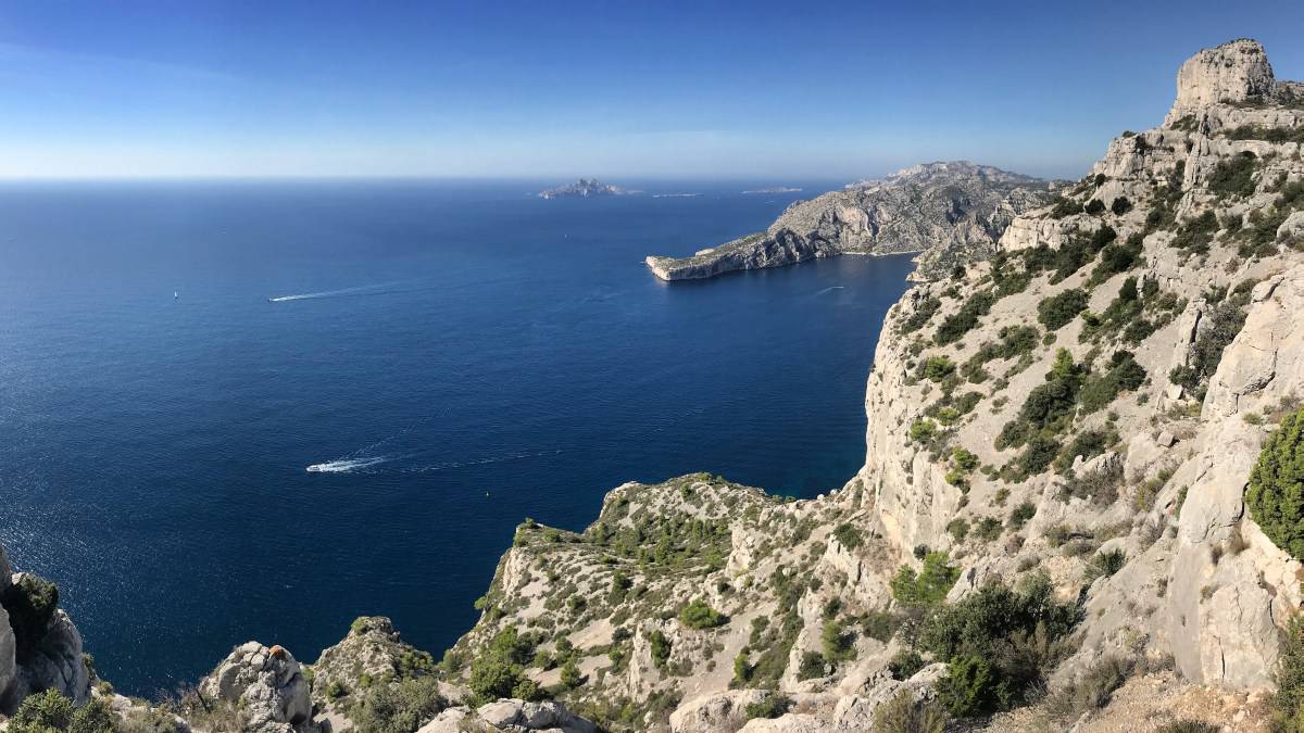
The fourth stage takes us on the GR 51 from Cassis to the spectacular fjord landscape of the Parc National des Calanques. Before starting the hike, however, you should find out whether the nature reserve is open for crossing.
In case of acute danger of forest fire (high temperatures or strong wind) the access for hikers is prohibited! This is especially between early July and mid-September regularly the case. The tourist office of Cassis informs directly on site and online about the access regulations (Link: https://www.ot-cassis.com/de/zugang-zu-den-calanques.html). Alternatively, information can also be found here: http://cg13.eway.fr/conditions.php. There, during the season, a daily updated table for the entire department of Bouches-du-Rhône is provided - for our hike, the third entry from the bottom is relevant ("Les Calanques entre Marseille et Cassis").
If access is closed, be sure to respect this: being in such a difficult-to-access area when there is a risk of forest fire can be life-threatening. Those who are affected by the closure and therefore cannot continue hiking as planned should allow themselves an extra night in Cassis, take a boat trip to the Calanques, lie on the beach or visit one of the wineries in Cassis (more info here: https://www.ot-cassis.com/de/). Those who hike between October and the end of May are on the safe side: the law, on the basis of which access can be regulated, is only applicable between 01 June and 30 September.
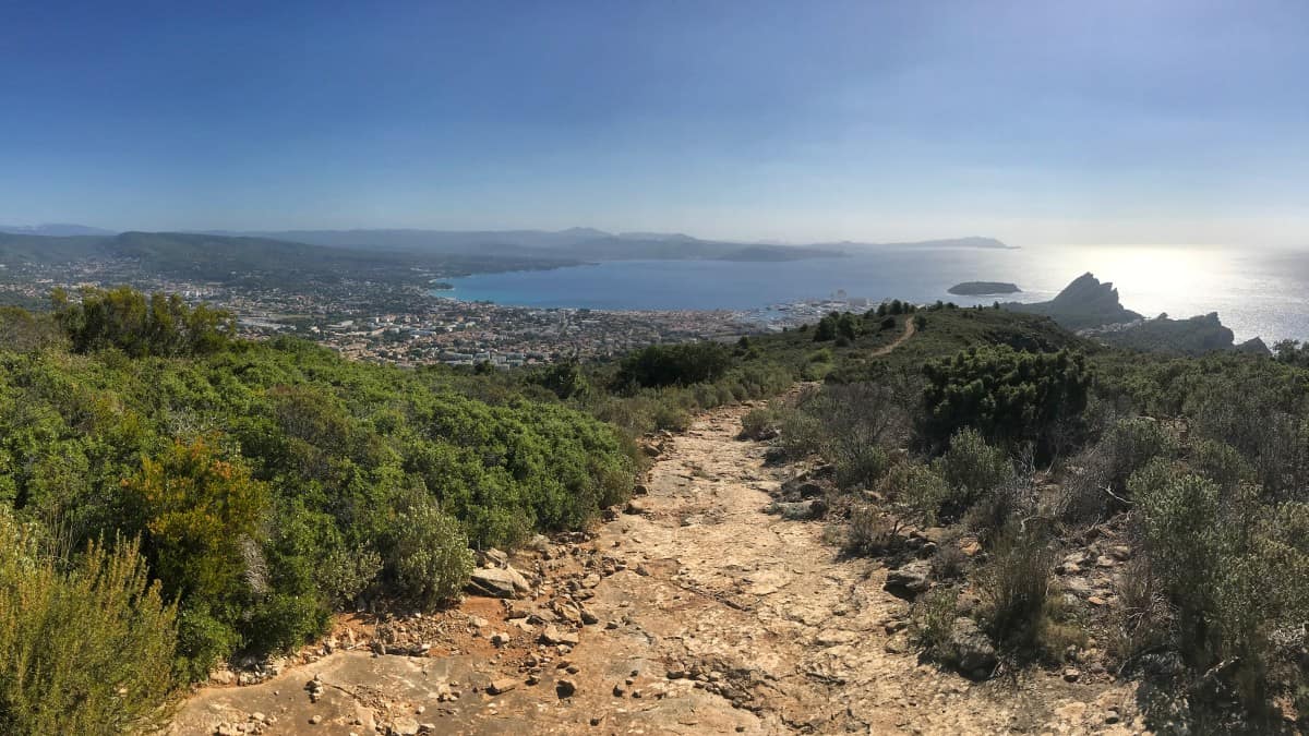
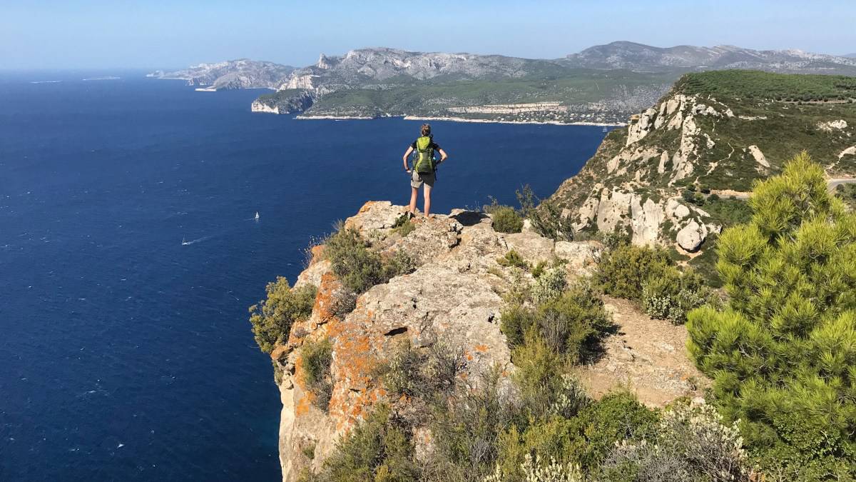
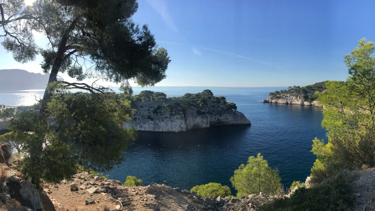
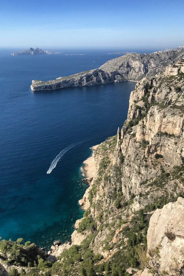
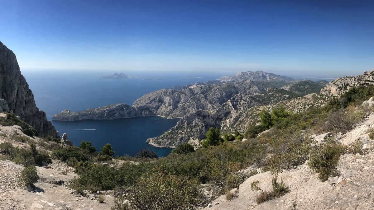
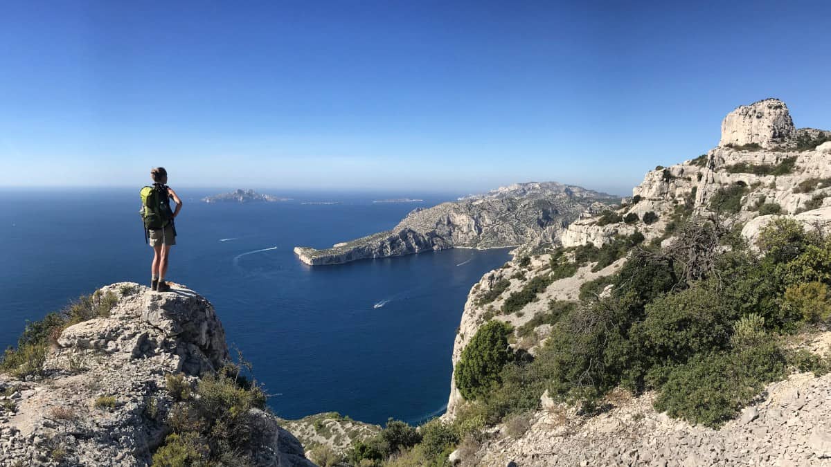
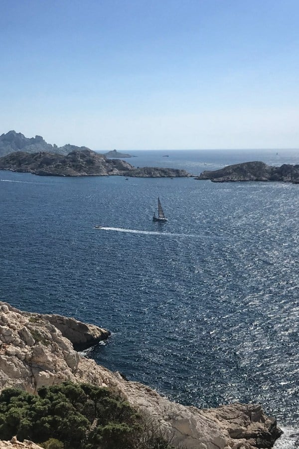
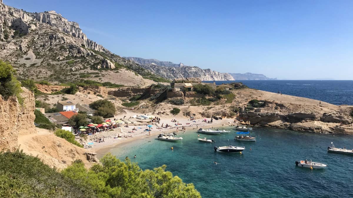
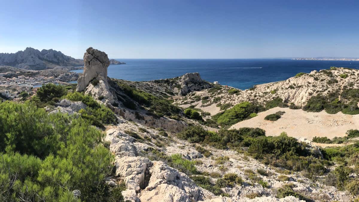
Today's hiking route leads us first along the natural harbor of the Calanque de Port-Miou and then on the GR 51 into the nature reserve. There is some up and down with quite a lot of altitude to overcome. But the effort is rewarded in clear weather with a 180-degree view over the entire coast: In the east, the reddish cliffs of Cap Canaille are visible, right behind it rises the silhouette of Cap Sicié (near Toulon). The eye-catcher in the west is Cap Morgiou with the calanque of the same name.
Facts about stage 4
Route: 15.7km
Altitude: 780 m ascent / 690 m descent
Duration: 6:30h (without breaks)
See also elevation profile
Downloads details
Refreshment stops along the way
No places to stop for refreshments on the way, take enough water and provisions with you!
Stage 4: accommodation

One of William's guest rooms
Overnight on the edge of the Parc National des Calanques
There are no accommodations in the Parc National des Calanques nature reserve itself, so at the end of stage 4 we have to switch to the southern outskirts of Marseille for the night. There are several alternatives for this:
- Overnight stay with William, who offers several guest rooms or apartments in one of the first houses on the edge of the national park (viacalanques.com, alternatively also bookable at Airbnb). William works as a photographer and has designed the rooms with great attention to detail. On request, William also offers breakfast (from 2 people, 7.50€ each). This is recommended, as there is no bakery or supermarket in the immediate vicinity of the accommodation. However, dinner is provided on site: At the end of the street is the pizzeria "Chez Ze". Especially on weekends, this pizzeria is very busy, so it is indeed advisable to reserve a table there directly while walking past at the end of stage 4. For those who prefer to supply themselves: At a distance of about 1.3 km straight down the main road there is a small fruit and vegetable vendor with local cheese and a few meters after that a bakery (about here). The nearest real supermarket is over 2 km away (here). However, the way there is anything but charming: one first passes a correctional facility and then encounters relatively large-scale apartment blocks that stand in sharp contrast to the nearby nature reserve. Our suggestion therefore: overnight stay at William's with breakfast, dinner at the pizzeria and filling up the water bottles for the next day with water from the tap. Provisions for the next stage is namely not necessarily needed -. see rest stops on stage 5.
- In case William's guest rooms are fully booked, or for those who want a little more comfort, there is an interesting alternative in Hôtel 96 (link: Hotel 96): Although you then have about 2 km longer way (past the prison, see above), but then ends up in a well-kept, park-like complex with a lot of comfort, large rooms and pool.
- As a last alternative, there is a bus connection at least every hour with line 22 in the direction of Marseille center with many more hotels (departure approximately at the level of William's house, Information about line 22).

William runs his small pension under the name "Le Garage des Calanques"

The guest room and one of the apartments can also be rented for single nights.
Stage 5: map
From Les Baumettes through the Parc National des Calanques to Marseille (Madrague de Montredon)
Stage 5: Directions


Through the Parc National des Calanques
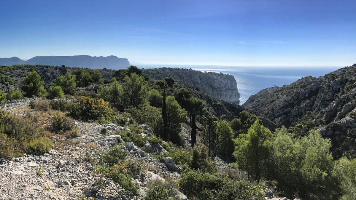
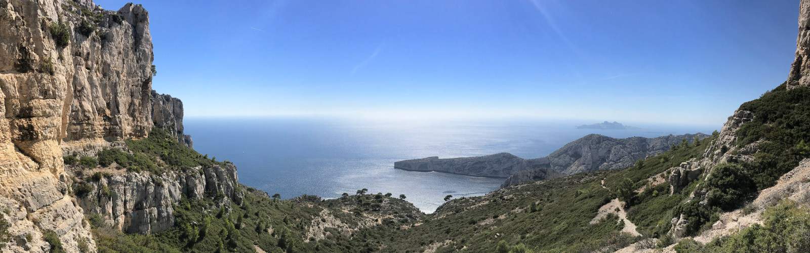
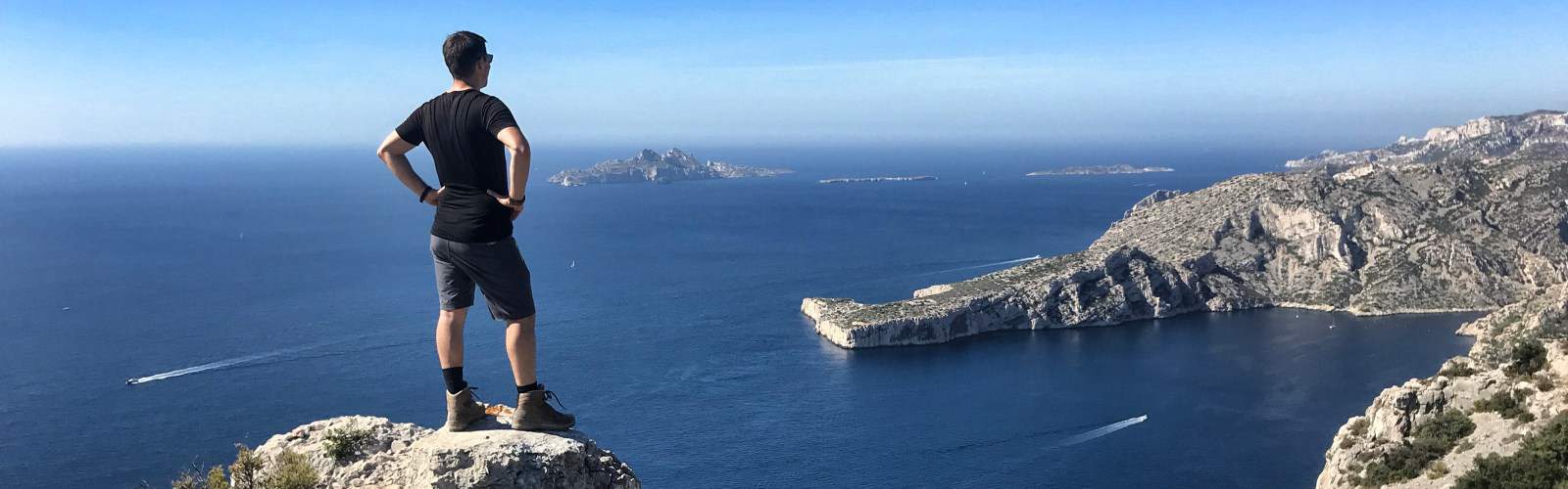
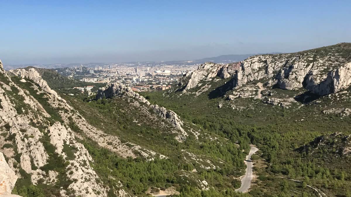
On the fifth stage we hike today through the beautiful southwestern part of the Parc National des Calanques. From Les Baumettes we first climb the Plan de Miette, from where we enjoy a great panoramic view of the coast and the offshore Riou islands. On the GR 51 we go slowly downhill and past numerous calanques until we reach Port de Callelongue (see also information in the section refreshment stops). Here we turn into the hinterland and hike a bit uphill again to Pas Edgard Garrigue, the only short via ferrata passage of our entire route (difficulty level: easy, bypassing is possible). With a view of Marseille and the famous former prison island of Chateau d'If, we then head towards the first suburbs of Marseille and thus the end of our hike.

The short climbing passage on stage 5 can also be bypassed if necessary
Travel by boat or bus to Marseille
In Madrague de Montredon there is the possibility to take the bus to Marseille (Bus line 19 to the metro station Castellane, change there and continue to the center).
If you fancy a boat trip instead, you can use the Navette Maritime boat service, which is part of the public transport system, at the port of Pointe Rouge (2 km further toward the center): For about 5€ per ticket, a ship departs here once an hour in the direction of Marseille/Port Vieux. Note: The boat connection is only operated in the summer half-year (usually from the end of April to the end of September). A timetable and further information are available here: http://www.rtm.fr/guide-voyageur/se-deplacer/navettes-maritimes.
Alternative: In the high season (from June 1st to September 1st, see link above), the Navette Maritime ferry service will be expanded again, so that you can already take the ship from Les Goudes to Marseille. To do this, leave the hiking route at Port de Callelongue. Instead of turning inland, you hike along the coast to Port des Goudes.
Facts about stage 5
Route: 12.3 km
Altitude: 480m ascent / 550m descent
Duration: 5:30h (without breaks)
See also elevation profile
Downloads details
Refreshment stops along the way
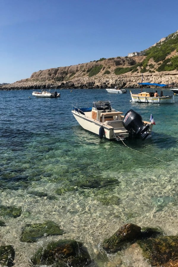
Lunch en route at simple but popular beach bistro "Chez le Belge" in the Calanque de Marseilleveyre (the opening hours are weather dependent and will be on Facebook announced) or upscale im Restaurant La Grotte in the Calanque de Callelongue

Stage 5: accommodation
Overnight in Marseille
The last leg of our long-distance coastal hike ends in a suburb of Marseille - so what could be better than to spend a few days exploring this interesting city? Hotels, guesthouses and lodgings are logically there for all tastes and preferences, so there is no need to recommend any specific accommodation here. Who will be killed by the selection: This link leads to the list of very good to excellent rated accommodations in Marseille on booking.com.